Introduction
A drone listing can show forty numbers and still fail to answer the one question that matters: will this drone do my job? Battery life, camera size, range, weight, sensors, and payload all look important, yet they mean little without a plan.
This is why choosing a drone is harder than it looks. You have to think about purpose, price, features, camera, flight ability, and the place where the drone will fly. Reading drone specifications is only the first step. Some people also find that hiring a trained pilot makes more sense than buying at all.
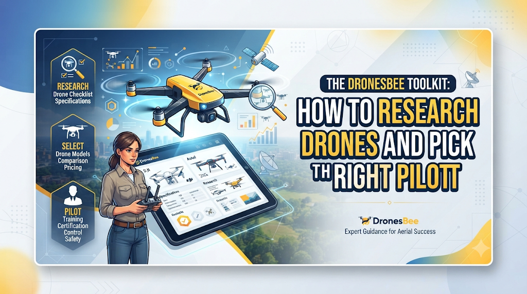
DronesBee is a drone and UAV platform that brings product research and professional operators together. This article treats it like a toolkit, with simple tools you can use at each stage of your decision.
What DronesBee Is, in One Short Tour
DronesBee is an online platform about drones and UAV technology. A quick tour shows four main areas.
The first area is the drone database. It holds products from makers such as DJI, Autel Robotics, Skydio, Parrot, and AeroVironment, plus other manufacturers. Product information and reviews appear with the listings.
The second area is for finding people. Service discovery tools and operator directories help users look for qualified pilots and professional drone work in real estate, filmmaking, construction, infrastructure, agriculture, environmental monitoring, surveying, and inspection.
The third area covers news, UAV technology topics, and regulation information.
The fourth area is community and learning, with forums and educational material. Together, these let a visitor read, ask, and compare before deciding.
Who Uses It and For What
Different visitors come for different reasons. This table shows what each group often looks for.
| Who | What They Often Research |
|---|---|
| Consumers | Easy-to-fly models, camera quality, size, and value |
| Drone enthusiasts | New releases, features, and owner discussions |
| Professional pilots | Equipment for paid work and changes in rules |
| Commercial operators | Tools for mapping, filming, or inspection, and ways for clients to find them |
| Businesses | Who can do a job such as a site map or a roof check, and what to ask |
| Researchers | How drone technology is used across different fields |
| Industry professionals | News, discussions, and market movement |
The same platform can serve all of them because the questions, though different, begin the same way: what am I trying to do?
Reading a Drone Listing Like an Expert
A listing has several parts, and each one answers a different question.
The name and maker. Start here to see who built the drone and what they usually focus on. Some makers aim at casual flying. Others build for business or specialist use.
The category. Camera drones, mapping drones, and industrial drones are built for different work. If the category does not match your task, stop reading and move on.
The numbers. Drone specifications list flight time, range, camera output, payload, sensors, and size. Read each one next to your task. A flight time that suits a short clip may fall short over a large field.
The user feedback. Drone reviews show how the drone behaves in real use, such as how steady it feels and what problems owners report. Give extra weight to reviews from people whose work looks like yours.
The side-by-side view. A drone comparison places two or three models together, so the trade-offs stand out. This is why a drone that is excellent for one person can be wrong for another.
A Simple Scorecard for Choosing Between Drones
People often search for the best drones and end up with a list that does not fit their needs. A scorecard makes the search personal. Write down the factors below. Give each one a score from 1 to 5 for how much it matters to you. Then check which drone covers your highest scores.
The factors are: intended use, camera needs, flight time, range, payload, sensors, size and portability, weather conditions, software, regulations, budget, maintenance, and support.
Here is a blank scorecard you can copy.
| Factor | How Much It Matters to Me (1 to 5) | Drone A Fits? | Drone B Fits? |
|---|---|---|---|
| Flight time | Yes / Partly / No | Yes / Partly / No | |
| Camera | Yes / Partly / No | Yes / Partly / No | |
| Payload and sensors | Yes / Partly / No | Yes / Partly / No | |
| Weather limits | Yes / Partly / No | Yes / Partly / No | |
| Rules in my area | Yes / Partly / No | Yes / Partly / No | |
| Full cost | Yes / Partly / No | Yes / Partly / No | |
| Repairs and support | Yes / Partly / No | Yes / Partly / No |
No drone covers every factor well. The best option is the one that meets your highest scores.
When a Person Beats a Product
Sometimes the right tool is not a drone but a trained pilot. If you only need a result, such as footage, a site map, or a damage report, professional drone services may suit you better than buying and learning.
A pilot does much more than fly. The operator listens to your goal, studies the site and the rules, plans the flight, keeps safety first, captures the data, and then prepares it in a form you can use. Businesses, construction teams, real estate agents, farms, infrastructure crews, filmmakers, environmental groups, surveyors, and inspectors all use this help.
The match matters because each job needs different skills. Film work needs smooth camera handling. Construction needs data you can trust. Agriculture needs some knowledge of crops. Inspection needs careful flying near structures. So the pilot, the equipment, safe practice, and a clear scope all count. DronesBee helps people look for operators across all of these areas.
Five Kinds of Jobs, Five Kinds of Care
Pictures from above
Aerial images show a place in context. Real estate teams use them to show land and neighbors. Media crews use them for scenes that are hard to shoot otherwise. Builders use them to record progress. Tourism groups use them to present a place fairly.
When you look at aerial photography services, think about the final use of the pictures. A sales page, a film, and a progress record each call for a different look.
Numbers from the ground
Walking a wide site with instruments takes time. A drone flies the area faster, and software turns the images into maps and models. These support land surveys, site measurement, and construction planning.
Drone surveying services suit large, uneven, or hard-to-walk ground. Ask what you will receive and how exact it must be.
Close looks at risky spots
Tall walls, narrow spaces, and unsafe roofs put people at risk. A drone can fly close, capture clear images, and let an inspector study them from a safe place. This applies to buildings, industrial assets, infrastructure, and construction sites.
Drone inspection services work best when the pilot understands the task and the person reading the images knows what to look for.
Health checks for fields
A large field can hide weak patches and uneven growth. From above, these often stand out. Drones can support crop monitoring and field assessment, so a farmer can act sooner.
Agricultural drone services vary by crop, field size, and equipment. Ask what will be monitored and how the findings will reach you.
Choosing a nearby operator
Many people start with a search such as drone pilots near me. A nearby pilot often means simpler planning, faster visits, and knowledge of local conditions. Before you decide, check these points:
- Has the pilot done similar work?
- Does the equipment fit the task?
- How are safety and local rules handled?
- What will you receive at the end?
- Is the scope written down?
Five Steps With a Tool for Each
Step 1: Define the Actual Need. Decide what the drone or service must achieve. Footage, a map, a structure check, and a field view lead to different choices. Tool: a one-sentence brief that begins with “When this is done, I want…”
Step 2: Identify the Required Equipment or Service. Decide whether you need a product or a professional. Frequent, simple work you can learn may justify buying. Rare, technical, or risky work often suits a professional. Tool: a count of how often you will need the result.
Step 3: Compare Important Factors. Compare specifications, features, and sensors for products. Compare experience, equipment, scope, and deliverables for providers. Tool: the scorecard above.
Step 4: Check the Provider or Product Carefully. Verify before you commit. Read user feedback and confirm support for products. Ask providers about past work, safety habits, and what the price covers. Tool: a short list of questions you ask every candidate in the same way.
Step 5: Match the Choice to the Project. Choose what fits your job, not what is most talked about. Tool: your Step 1 sentence, read again, to confirm the choice still fits.
Wrong Turns and Their Warning Signs
- Choosing by popularity. Warning sign: your reason for choosing is “everyone has it.”
- Choosing by price alone. Warning sign: you cannot say what the cheaper option leaves out.
- Skipping drone specifications. Warning sign: you do not know the flight time or payload of your pick.
- Comparing without a use case. Warning sign: your notes have no mention of your job.
- Hiring without checking experience. Warning sign: the pilot cannot show similar past work.
- Ignoring local rules. Warning sign: nobody has mentioned permissions or restricted areas.
- Neglecting upkeep and safety. Warning sign: you have no plan for spare batteries, repairs, or safe flying.
A Made-Up Story: A Regional News Team Covers a Flood
A small regional news team wants aerial views of a river that has flooded nearby farmland. It also wants a few calm aerial shots of the same area once the water goes down.
The editor starts with a brief: clear aerial footage now, and matching shots later for comparison. Then she asks whether the team should buy a drone. Nobody on staff can fly one, the conditions are difficult, and safety around water and people is a concern. She leans toward hiring.
She lists what the job needs: a camera that records clear footage, steady flying in changing weather, careful handling near people, and attention to local rules. She looks for nearby pilots and compares three using a short list of questions. She checks sample footage, equipment, and what each will deliver.
One pilot has worked with media teams and explains the plan for weather delays. The editor agrees on the scope in writing and books that pilot. A large broadcaster that covers events every week might choose to buy its own equipment and train staff.
Frequently Asked Questions
1. What is the drone database for, in simple terms?
It is the part of DronesBee where you can study drone models, makers, specifications, and related product information before choosing.
2. How many specifications should I really care about?
Focus on the few that affect your task, such as flight time, camera, payload, and sensors. The rest matter less.
3. Why use a scorecard?
A scorecard forces you to decide what matters before you see the options, which keeps you from being swayed by big claims.
4. What details help a pilot give a clear quote?
Share your goal, location, timing, site access, and the files you expect. The clearer the details, the clearer the quote.
5. Why might a pilot decline a job?
Safety, local rules, weather, or a mismatch with their skills can be reasons. A pilot who says no for good reasons is showing care.
6. Should I watch sample work before hiring?
Yes. Sample footage, maps, or reports show the pilot’s style and quality and tell you whether they fit your project.
7. What about privacy when flying near homes?
Respect privacy and follow local rules. Ask the pilot how they handle flights near people and private property.
8. How do news and regulation pages help buyers?
They show what has changed in the field and what rules may affect your plans, so you are less likely to be surprised.
9. What is the difference between a one-time job and ongoing monitoring?
A one-time job captures one moment. Ongoing monitoring repeats flights over time to show change, which is common in farming and construction.
10. Is it fine to ask a pilot for references?
Yes. Past clients or examples of similar work are a normal and fair request.
Conclusion
Think of this article as a small toolkit: a way to read listings, a scorecard to compare drones, and a short list of questions for pilots. DronesBee sits behind both halves of the drone world, with research on drones, drone specifications, and reviews on one side, and a way to look for skilled operators and professional services on the other. Whichever side you need, the same sensible checks apply. Start from your actual requirement, look closely at what the drone or pilot can really do, and think about the project conditions, the experience behind the work, safety, local regulations, and the full cost, including upkeep. Use those tools in that order, and the decision usually becomes a calm, clear one instead of a guess.